Description
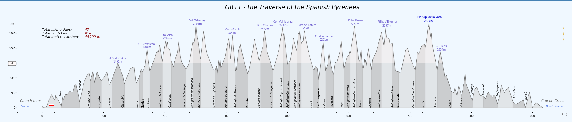
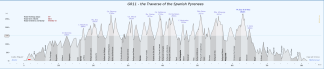
Elevation profile poster for the GR11, the complete traverse of the Pyrenees mountain range from the Atlantic Ocean (Cabo Higuer) to the Mediterranean Sea (Cap de Creus), alaways on the spanish side.
The hike usually takes 47 days to be completed, ascends more than 45000 meters, and runs along 812 km.
Features:
- elevation profile
- color stripes pattern to clearly show different stages
- high elevation hike color pattern
- Start and Ending locations
- Start and End of different sections
- Start and End of each stage
- Mountain passes
- Basic stats
Colors: Greys / Greens / Browns
Languages: English / Catalan / Spanish
Reviews
There are no reviews yet.